Management and follow-up drilling
Operational management advanced drillings
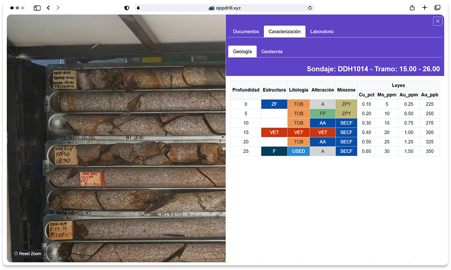
Integrates images and documentation of wells with data geoscientists, to get instant access to key information that supports your process of interpretation, and modeling.
Automation of information
Centralization of documents
💻 Greater efficiency in capturing and editing
Integration with modeling software
Centralization of documents
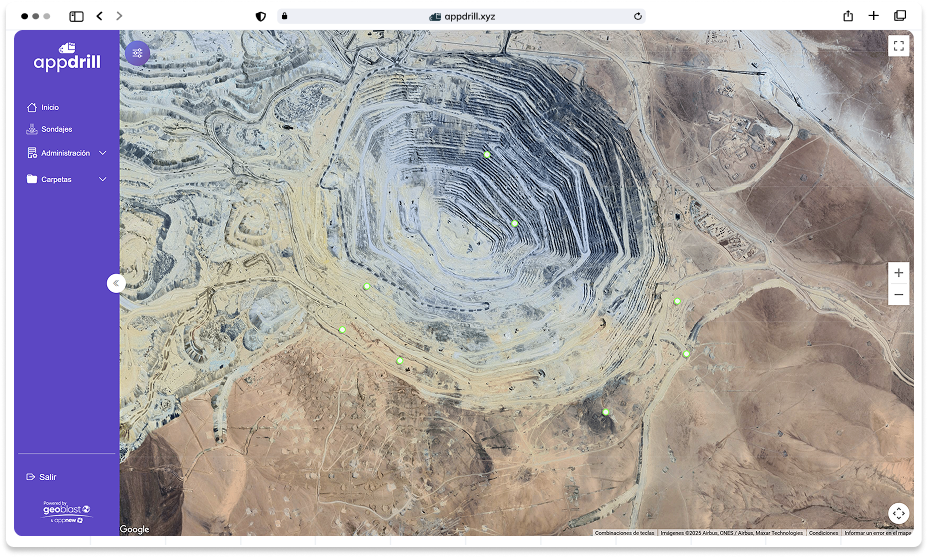
AppDrill is designed for managing geoscientific information of any mine, either open pit or underground.
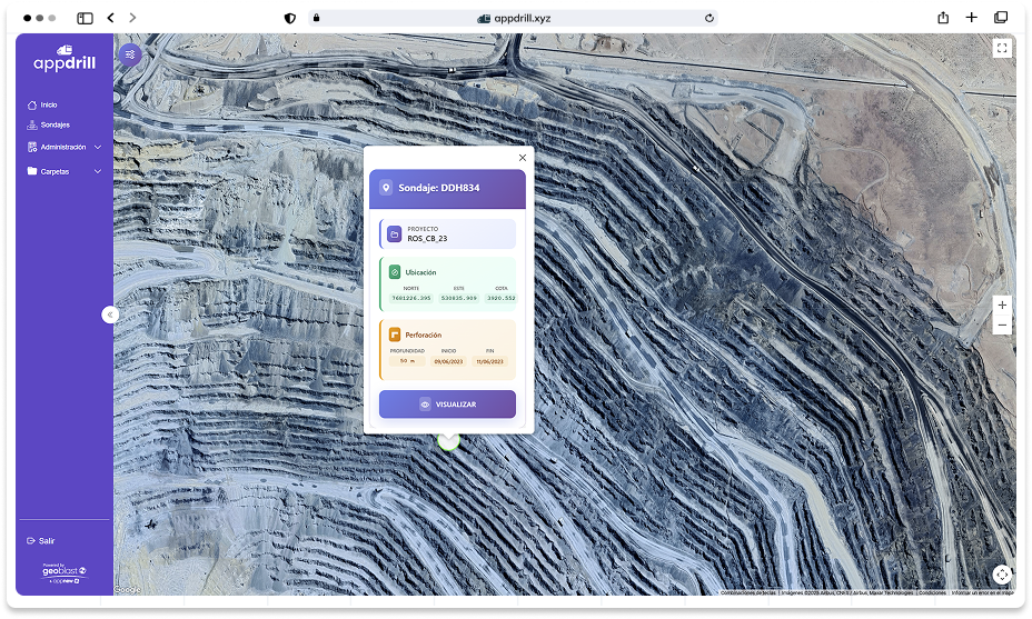
Simple navigation
To enter you can view the sections of the mine in which you are working.
- Simple control of the drilling of the field (by clicking you will be able to view a preview)
- Filter by drillings
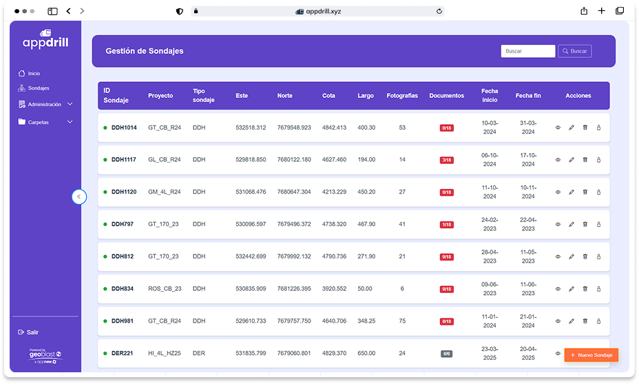
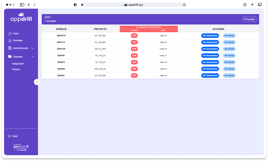
Management of drilling
Here you will be able to view your projects, coordinate the images that you've uploaded, dates of the perforation, and a glimpse of the uploaded documents.
Also you will be able to:
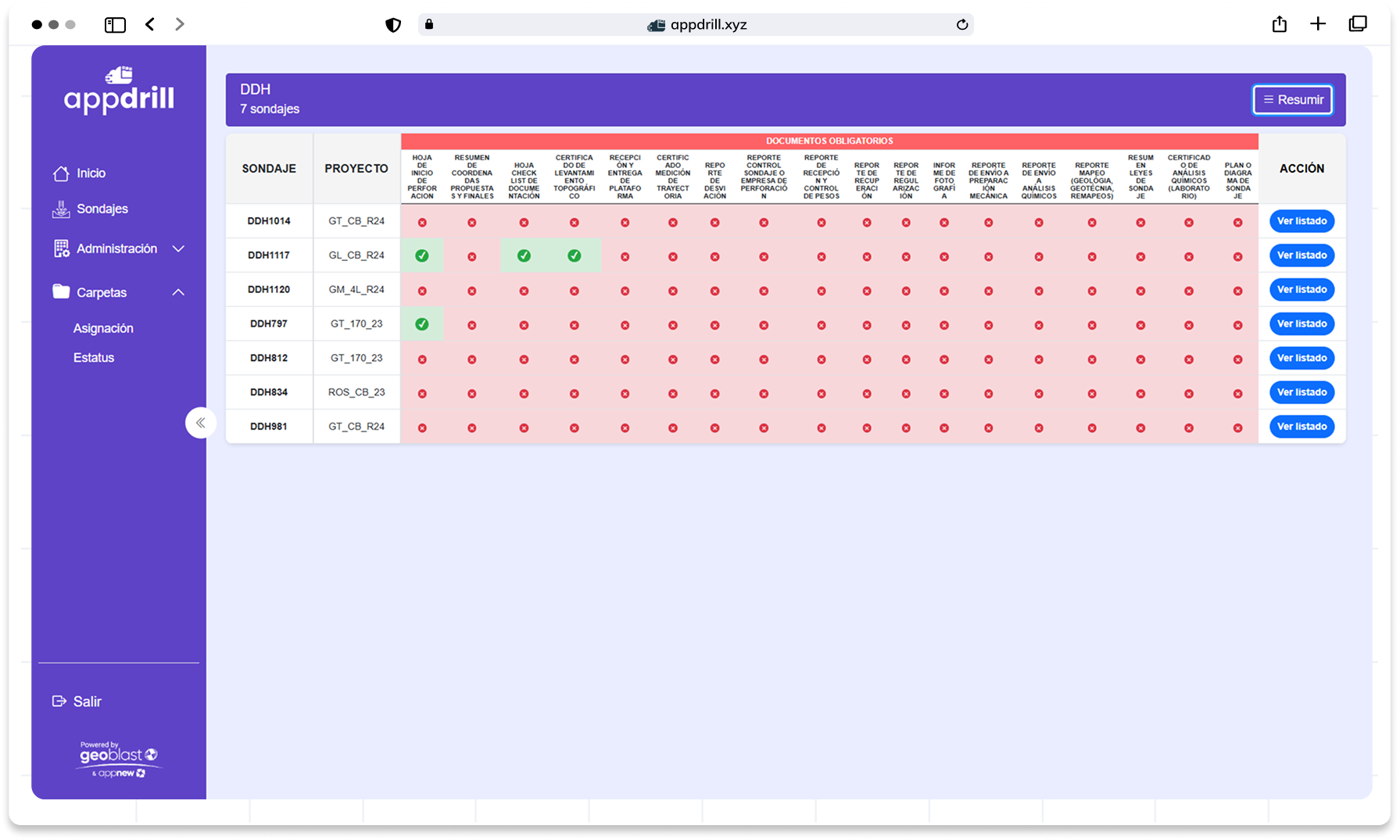
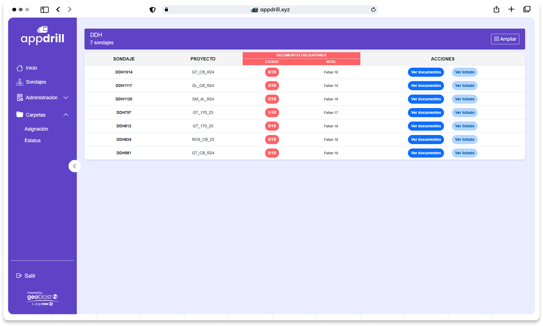
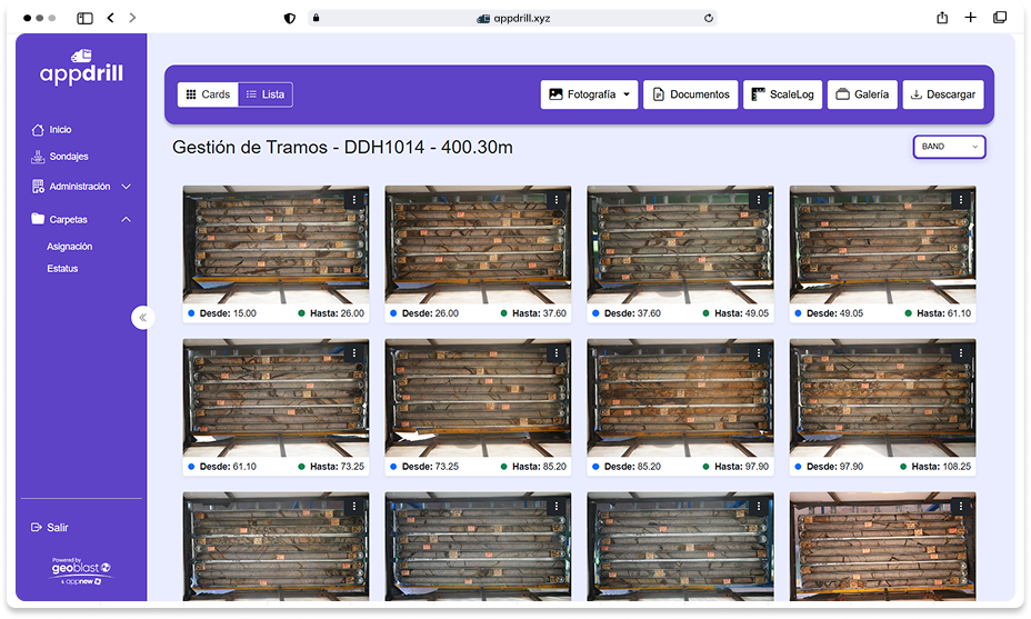
Management sections
The display you'll be able to see all of the images that have been uploaded, as a tray or a point load.
Data visualization
To grant permission to your database you can view a characterization of the data entered.
Document management
You'll be able to assign which documents are mandatory or pre-requirements for an audit.


 Intelligent organization of data